Two recent posts at Grognardia have me wondering : why do so many role-playing gamers love to make maps?

Maps were one of the things that hooked me on D&D. As a kid, I would draw maps of dungeons I never intended to populate with monsters, for the sheer joy of placing a dais here and a pit there, a crevasse bisecting this cavern and a reef of stalagmites bisecting that.
I remember seeing TSR’s books of dungeon geomorphs, templates for rooms and corridors that a DM could use for quickly generating a setting for a dungeon crawl. I also remember thinking, “Where’s the fun in that?” I disliked the notion of anyone compromising my authority as demiurgic Placer of Walls. If I wasn’t drawing it from scratch, I preferred using a published scenario with its pre-drawn map instead.
Maps in our culture are largely utilitarian. Cartographers and map designers create models of the world using a greater or lesser degree of symbolic abstraction, chosen on the basis of the map’s purpose and audience. A topological map renders the twists and turns of actual subway tracks as smooth, primary-color lines connecting stations, and ignores elevations or surface boundaries. A topographical map by a government geological survey might model in detail roads or wells that later construction obliterates. The makers of both maps strive to create images of maximum utility for their audience.
How do we define utility when we map imaginary places?

I should disclose that I am increasingly biased against using the rhetoric of modern cartography—especially uniform distances—in non-modern game settings. Part of the function of a non-modern setting is to narrow the channels of information available to characters, such that even the best-educated citizens of a pseudo-medieval or post-apocalyptic metropolis would have a fragmentary, distorted, and ethnocentric picture of their world (that is, if the game master simulationist enough to value verisimilitude over utility, which isn't necessarily a good thing). In such a setting, no satellite eyes render the world in false-color grids, and the only maps are drawn, or painted, or engraved by hand.
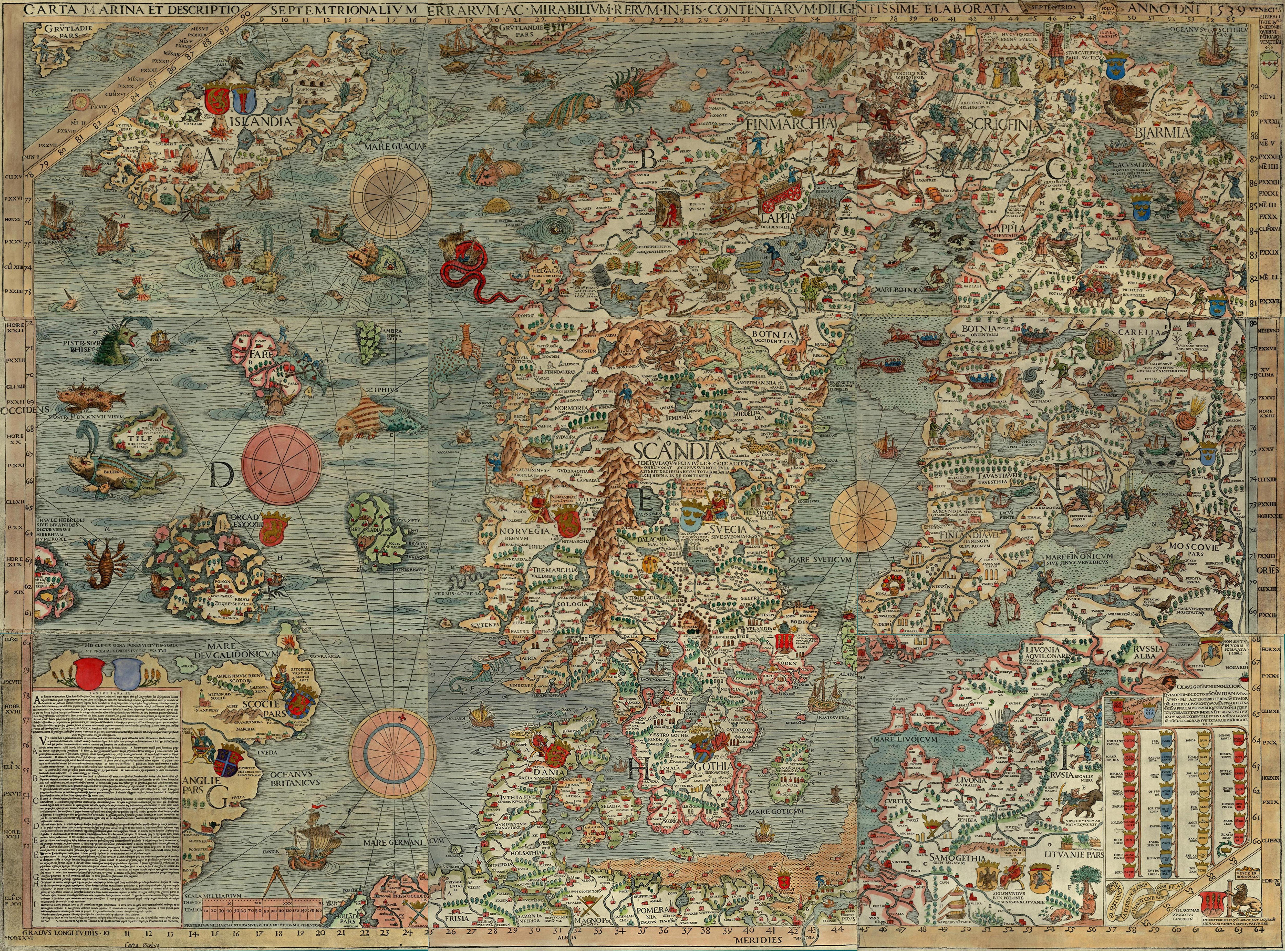
Pre-modern maps offer more productive models for our fantasy-game mapping. They abstract the world on the basis of different standards of utility or symbolic importance. The ancient Babylonian Imago Mundi and the medieval European “T and O” maps are more useful for imagining cosmological relationships than for navigating between places. Olaus Magnus’s illustrated map of Scandinavia gives approximately accurate outlines for landmasses, but populates their surface with cartoon figures that range from the ethnographic to the cryptozoological and beyond. Might the most evocative and imaginatively-useful campaign maps be the ones that make no pretense to representing an imagined world as it actually might look to a spy-satellite? Such maps would be less useful to a group of players estimating how many days of provisions to buy for a voyage, but the maps that Columbus and Raleigh used were little better.
Are maps that seem like credible products of a pre-modern culture (i.e. hand-drawn, incomplete, spatially inaccurate) more trouble than they’re worth, in a role-playing game? Does the map, in a fantasy game, become the closest thing we have to a “territory” that two players can actually point to and say, “This much is real”?
Are maps that seem like credible products of a pre-modern culture (i.e. hand-drawn, incomplete, spatially inaccurate) more trouble than they’re worth, in a role-playing game? Does the map, in a fantasy game, become the closest thing we have to a “territory” that two players can actually point to and say, “This much is real”?
No comments:
Post a Comment